

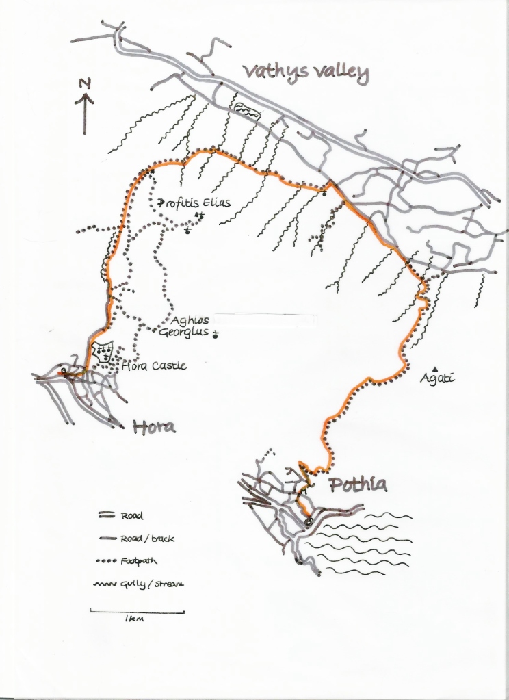
A classic Kalymnian walk with a wiggle. Wind your way out of the noisy port town of Pothia for a meditative ascent of the paved Italian path. Glide through a broad pass and descend to the flower scented farming valley of Vathys. Follow the bees and grasshoppers along a quiet farm track to a church then thread back up through the ridge and descend below the ancient castle to rejoin the bustle at Hora. Distance 11km, Height Gain 810m. The public bus can be used to access the start and finish of the walk.
PLEASE REMEMBER most paths on Kalymnos are very rough underfoot and sparsely marked, maps lack the detail of many other European maps and especially, from May to the end of October, the utmost care needs to be taken to avoid potentially fatal heatstroke. There is some excellent advice here: https://www.mountaineering.scot/safety-and-skills/essential-skills/weather-conditions/heat
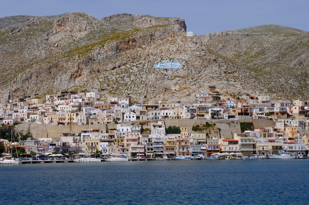
Photo credit: Sally Woodbridge
In Pothia follow the street signs to the Archaelogical Museum of Kalymnos. Continue uphill with the museum entrance on your right to a T junction. Turn right, then first left, then left at the T junction. Keep right and as the road ends the paved Italian Path swings off to the right. There is some signage and locals will help you find the start of the path.
The natural harbours of Kalymnos have brought both riches and death. Archaeological finds on the island show trading with Samos, the NE Aegean, the Cyclades and Asia Minor during the Late Neolithic (5300-4500 BCE). However inhabitants had to retreat inland to escape raids by the Arabs in the C7th, the Seljuk Turks in the C11th, the Turks in the C15th and the Spanish and Venetians until the mid-C17th.
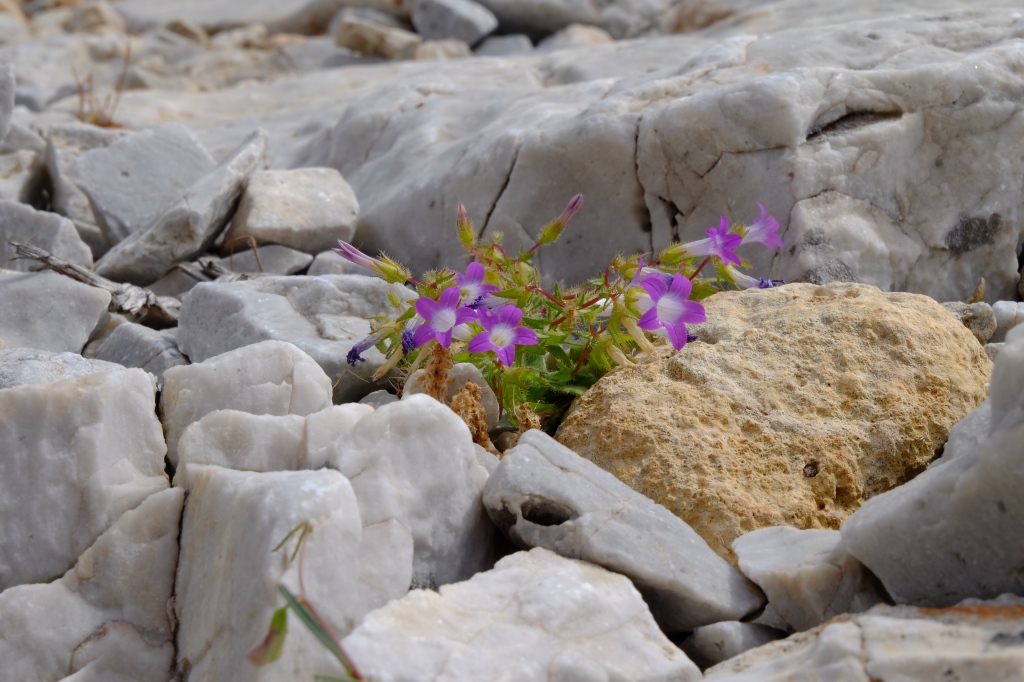
Photo credit: Nick Haine
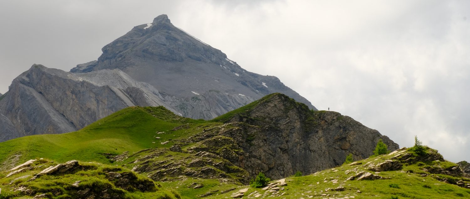
Although the paved path is showing some signs of wear it is easy to follow and well marked on the ascent and through the pass. It is less well marked, but still discernable, as it descends on the left hand side of a gully to the Vathys Valley to meet a wide dirt track.
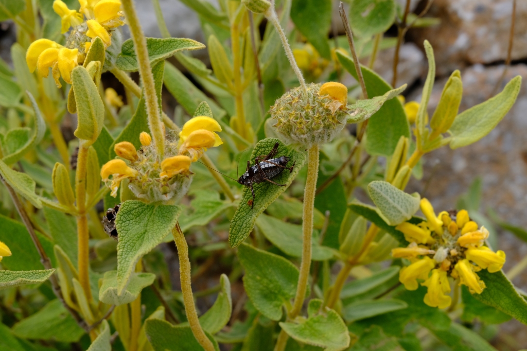
Photo credit : Sally Woodbridge
Turn left onto the dirt track and follow this for about 1.5km then turn left to the small church Aghios Nikolaos. Go right through the gate in the fence and keep below the wall on a gently rising path. When the wall ends continue ahead on a path marked with red dots until you pass through a gully level with the far (northern) end of the reservoir below.
Many perennial plants on Kalymnos are geophytes meaning that they survive the hot dry summers as dormant underground storage organs such as bulbs, tubers, rhizomes or corms. The seemingly barren red earth of the autumn conceals their presence.
The path climbs more steeply now but is still marked with red paint dots. It passes easily through the next deep gully then rises to a fence on the hillside above. Bear left after this fence towards stone shelters and a wall.
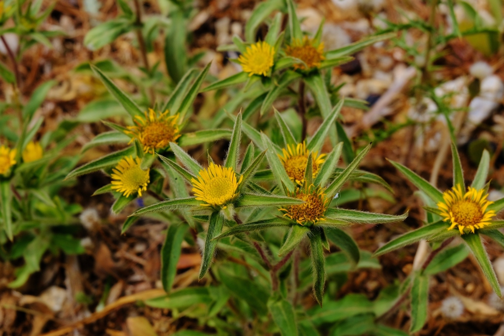
Photo credit: Sally Woodbridge
Descend on a clear path for 1.2km with the wall on your left. Then pass through a gully to a small farm. Continue ahead on the farm track to the outskirts of Hora. Take the third turn on the right and this will lead you to a widened triangular section of road with the bus stop.
The castle of Hora (Chora) was built in the C11th due to raids by the Seljuk Turks although the area had probably been inhabited since the C10th. It was repaired and enlarged during the occupation of the islands by the Knights Hospitaller, a Catholic military religious order, in response to Turkish raids precipitated by the Fall of Constantinople in 1453. It was inhabited until 1750.
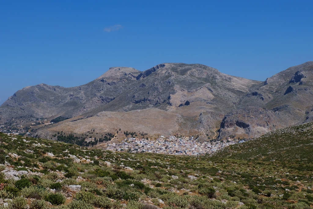
Photo credit: Sally Woodbridge
Please remember that outdoor activities like walking come with inherent risks. The author has endeavoured to make the information as accurate as possible at the time of writing but the decision to undertake the walk is entirely at your own risk. No responsibility can be accepted for any kind of physical injury, loss or damage to you or your property.
- Dawson, Carl (2015), The Kalymnos Trail, Terrain Editions, Greece.
- Thorogood, Chris (2019), Field guide to the wild flowers of the Eastern Mediterranean, Royal Botanic Gardens, Kew, UK.
- 1:25,000 map, no.337 Kalymnos, Telendos, Terrain Editions, Greece.
