

A circular walk in the north of the island around the Arginonta valley. This walk is accessible by public bus and has an optional extension to a viewpoint, the Italian Emplacement. Inhale the scent of wild thyme, gaze across blue seas to Turkey and cool down beneath a grove of ancient olive trees. This walk mainly uses marked paths and includes a short section of the Kalymnos Way. Distance / height gain: 11.5km and 600m ascent / descent (including optional extension).
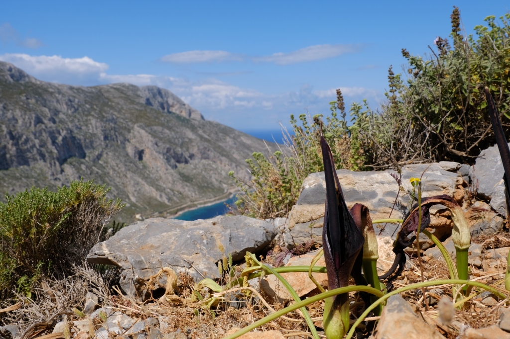
Photo credit: Sally Woodbridge
PLEASE REMEMBER most paths on Kalymnos are very rough underfoot and sparsely marked, maps lack the detail of many other European maps and especially, from May to the end of October, the utmost care needs to be taken to avoid potentially fatal heatstroke. There is some excellent advice here: https://www.mountaineering.scot/safety-and-skills/essential-skills/weather-conditions/heat
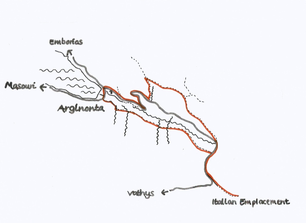
Map by Sally Woodbridge
Disembark the bus in Arginonta at the junction with the road to the Vathys Valley, there are also plenty of parking spaces here. Ascend the road towards Vathys for 2km passing two switchbacks. At a small concrete wall on the left with red markings and a painted letter K turn left. Ascend on the left of a small gully following red paint marks and cairns. This is the path climbers use to access the Arginonta Skyline Crags.
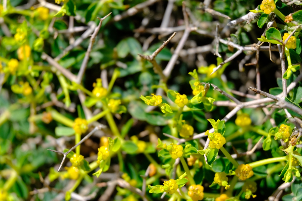
Photo credit: Sally Woodbridge
The path continues upwards with small crags on the right (not marked on the Terrain Editions map) to a path junction at an altitude of 300m. Turn right and pass through the break in the crags on a defined path heading parallel to the ascending road on your right for 1km. Pass to the left hand side of a small rise to reach a stone-walled enclosure and juniper trees. Exit the stone enclosure from the far right hand end. Continue ahead on the path to gradually converge with the road as it bends and heads south.
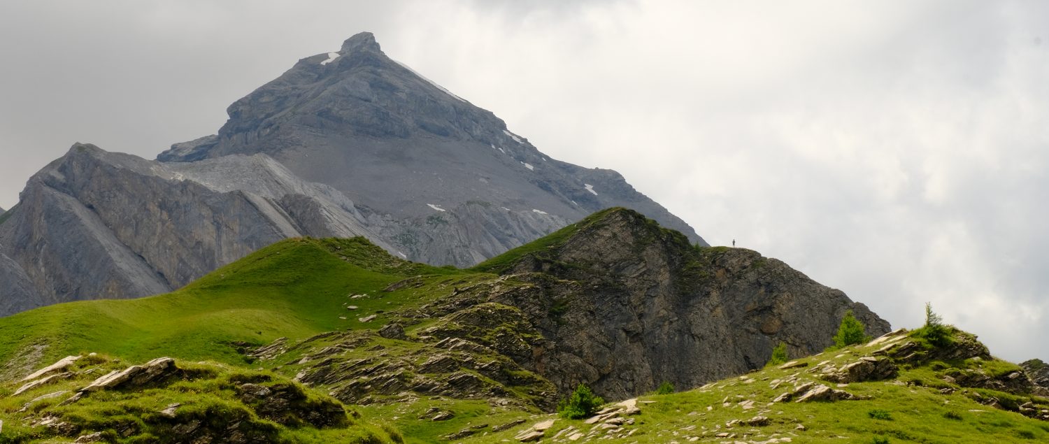
The first type of habitat you pass though on this walk is known as Garrigue, a challenging environment but home to plants such as thyme and oregano. It experiences extreme water stress, is prone to soil erosion and is exposed to weather fronts. The dense. shrubby low-rise woodland on the ridge is known as Maquis. Here heart-shaped cyclamen leaves nestle in the limestone crevices, shaded by the berry-laden juniper.
If you don’t wish to head to the Italian Emplacement continue ahead on the road for 20m then turn right through the road barrier.
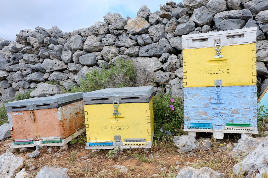
Photo Credit: Sally Woodbridge
Optional extension to the Italian Emplacement viewpoint: To visit the viewpoint of the Italian Emplacement continue ahead on road for 80m and bear left into car parking area. Walk towards the red roofed shelter and carry on in a south-easterly direction for 500m to the high point of a juniper-wooded area that conceals the large flat stone paved circles of the Italian Emplacement. There are good views north to Pezonda Bay and south to the fertile Vathys valley. Return by the same route to the car parking area. Turn right back along the road for 60m, then turn left through the road barrier.
As part of the Ottoman Empire from 1523 Dodecanese enjoyed a high degree of autonomy for nearly 500 years, this relationship ended when they were occupied by the Kingdom of Italy in 1912 during the Italo-Turkish War. Initially the Italians made positive improvements to the islands’ infrastructure and eradicated malaria but under Mussolini a programme of forced italianization sought to replace local culture. Italy’s surrender in World War II led to German occupation of the islands from 1943-5. In 1947 Kalymnos officially passed to Greece.
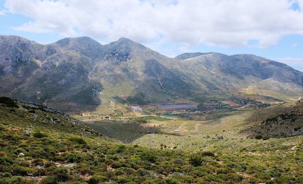
Photo credit: Sally Woodbridge
After passing through the road barrier follow a small path beside a wired in enclosure and begin to descend. Stay on this path for approximately 3km following small cairns and staying above the walled and wired in enclosures on your right. After approximately 3km descend through a small gully into a section of old olive trees to a farm track that becomes a small road. Turn left down the road and meet the main road in 200m. Turn right and continue to the bus stop.
Photo credit: Sally Woodbridge
Olive oil, thyme honey and goat’s cheese are all produced on the island. Mini market Fani’s on the northern edge of Masouri, Armeos, sells all these as well as delicious homemade jams and chutneys. Traditional treats include the ridiculously moreish loukoumades, fried doughballs you dunk in thyme honey, and bougatsa, a custard filled breakfast pastry drizzled with the sweet, fragrant stickiness.
Practicalities: The public bus runs from Pothia to Emborios and back twice a day, every day from the end of April until the end of the summer season and on Mondays, Wednesdays and Fridays the rest of the year https://www.kalymnos-isl.gr/en/information/bus-itineraries/23-english/information .In Arginonta there is a beach and two cafes, one a short way beyond the road junction to Vathys.
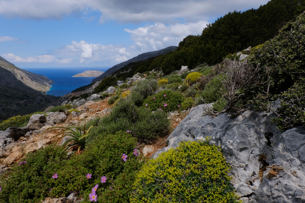
Photo credit: Sally Woodbridge
Please remember that outdoor activities like walking come with inherent risks. The author has endeavoured to make the information as accurate as possible at the time of writing but the decision to undertake the walk is entirely at your own risk. No responsibility can be accepted for any kind of physical injury, loss or damage to you or your property.
- Dawson, Carl (2015), The Kalymnos Trail, Terrain Editions, Greece.
- Thorogood, Chris (2019), Field guide to the wild flowers of the Eastern Mediterranean, Royal Botanic Gardens, Kew, UK.
- 1:25,000 map, no.337 Kalymnos, Telendos, Terrain Editions, Greece.
