

This two day walk leads you through the meadows, woodland and mountains of the Puez-Odle / Puez-Geisler Nature Park in the Dolomites in Northern Italy. The iconic Dolomites Alta Via 2 is followed on the second day and there are overnight stays in the Schlüterhütte / Rifugio Genova and the Puez Hütte / Rifugio Puez.
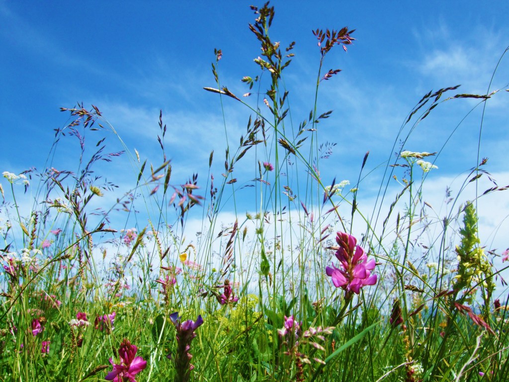
Photo credit: Sally Woodbridge
- Start / Finish: Start the first day in Ortisei / St Ulrich in Val Gardena / Gröden by taking the Funicular to the Resciesa / Raschötz Plateau. You finish the second day in the Puez Hütte / Rifugio Puez. Selva / Wolkenstein is a nearby town with good accommodation options and transport links.
- Distance: Day 1: 14.1km Day 2: 9km
- Ascent / Descent: Day 1: 650m ascent / 450m descent. Day 2: 625m ascent / 450m descent.
- Grade: Day 1 – Grade 2 (moderate difficulty necessitating a reasonable level of fitness and care on typical rocky alpine terrain); Day 2 – Grade 3 (strenuous steep climbs and descents involved, possible exposed stretches; experience preferable. (Cicerone guidebooks definitions)).
- Time: Two days. Day 1: 4hrs 30 Day 2: 4hrs 30 (walking time only)
- Maps: Tabacco Val Gardena – Alpe di Siusi / Gröden – Seiseralm 05 1:25,000
- Access: There is good public transport access to Val Gardena / Gröden. There are regular buses linking Ortisei / St Ulrich main square and Selva / Wolkenstein with Bressanone / Brixen, Bolzano / Bozen, Ponte Gardena / Waidbruck train stations, and to Corvara in the neighbouring Alta Badia valley and Canazei in the Val di Fassa. The Resciesa Funicular is a signposted 10 -15 minute walk / escalator ride up to the northern edge of the town.
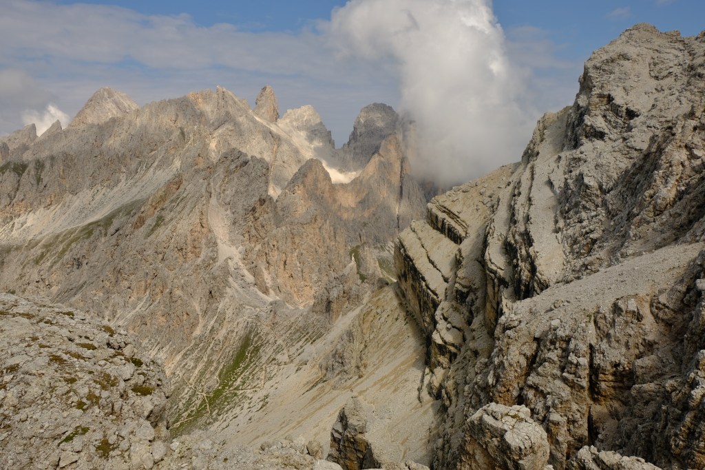
Photo credit: Sally Woodbridge
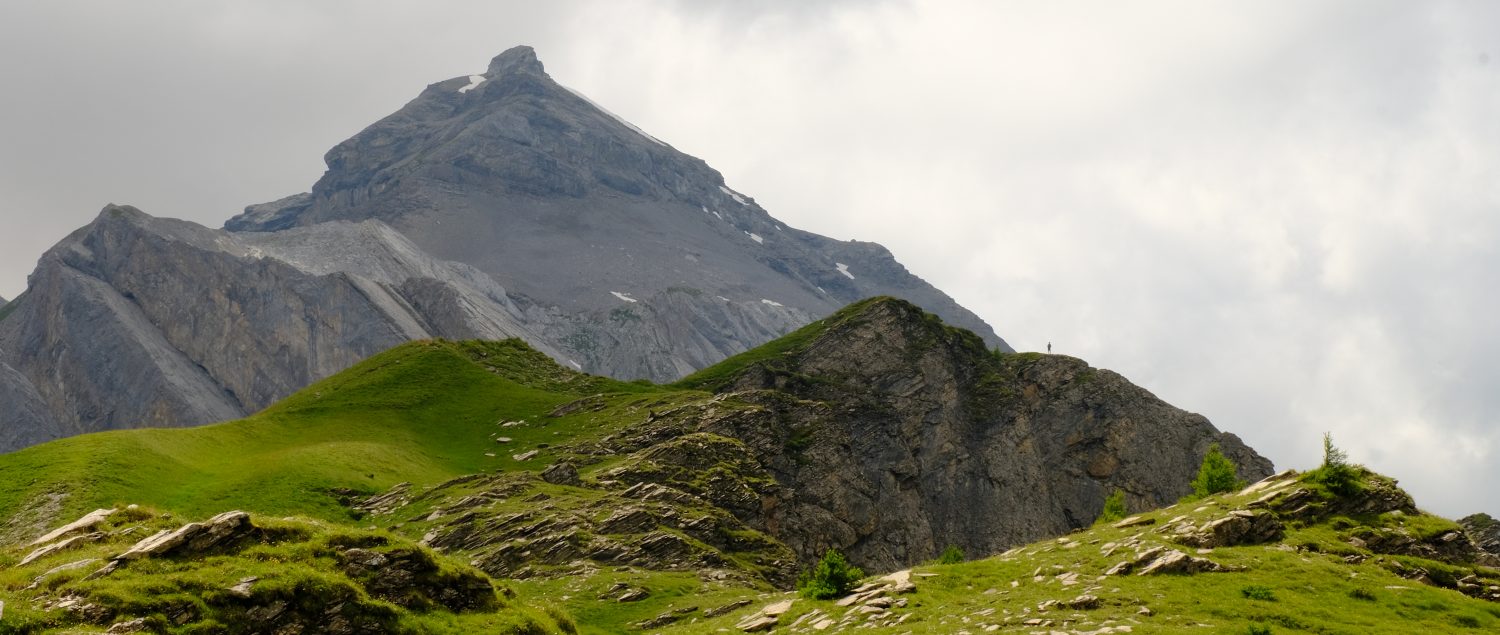
The route begins on the Resciesa / Raschötz Plateau high above Ortisei / St Ulrich, the cultural hub of Val Gardena. These horse and donkey grazed slopes can be under snow from November to May but bloom with pink alpenrose during the summer. After following the northern edge of the plateau the route dips down to the traditional Brogles Hütte. From here there are superb views of the spiky, dolomitic limestone north faces of the Odle / Geisler peaks above and the tranquil meadows of Val di Funes / Villnösstal below.
The complex shifts and folding of rocks 50 -80 million years ago during the formation of the main spine of the Alps happened to a far lesser degree here. In areas such as the western slope of Seceda, visible from the Resciesa / Raschötz Plateau, the original rock sequencing remains intact. This is why the Puez-Odle / Puez – Geisler Nature Park is sometimes referred to as ‘the history book of the earth’. Another geological highlight is the dolomitic limestone. This is named after the French scientist Deodat de Dolomieu who noted in 1789 that this limestone possessed higher levels of magnesium. In the evening when the low sun strikes these sheer rock walls they change colour from orange to pink to violet. This is known as enrosadira in the local Ladin language.
Beyond the Brogles Hütte threads of silver scree strewn paths snake up through the Odle / Geisler peaks, but this route stays lower on the undulating Adolf Munkel path on the upper edge of the stone pine woodlands. Sun baked scree is dotted with lilac round leaved penny cress and purple hepatica nods in the shade. The superbly named Schlüterhütte, also known as Rifugio Genova, is reached after a last uphill section on a broad farm track.
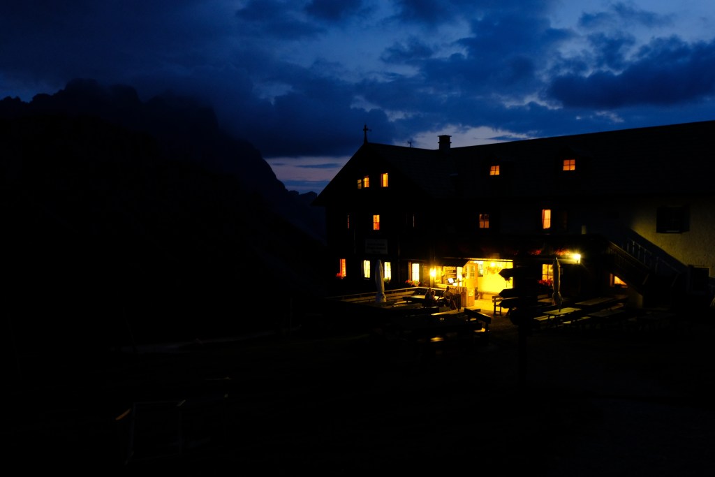
Photo Credit: Sally Woodbridge
The echoes of major world events can be traced through the multiple names of many of the mountain refuges in this area. The Schlüterhütte was originally built by a Dresden merchant in 1898 when the South Tyrol was part of the Austro-Hungarian Empire. On completion he gifted it to the Dresden section of the German Austrian Alpine Club (DuÖAV). When the South Tyrol was ceded to Italy after the First World War the hut was expropriated by the Italian government and passed to the Italian Alpine Club’s (CAI) Genoa section becoming Rifugio Genova. By 1972 South Tyrol had become an autonomous Northern Italian province and in 1999 the hut became the property of the Autonomous Province of Bolzano / Bozen – South Tyrol. Some local huts even have a third name in the ancient local Ladin language like the nearby Utia de Ncisles, also known as Rifugio Firenze or the Regensburgerhütte.
Day two follows the renowned Dolomites Alta Via 2, also used for the epic Munich to Venice long distance path. After some impressive views south to the mountainous Sella range, the remains of a tropical atoll formed in the long vanished Tethys Sea, the route enters the iconic Dolomites terrain. Sheer cliffs and rubble strewn slopes echo with the harsh laughing calls of the alpine chough, the clever mountain crow. Narrow trails slice across and zig-zag up the dusty grey inclines to the scoured, barren pass Forcella dla Roa (Roa means mudslide in Ladin). Forcella Nives is finally reached by weaving up a steep rock face equipped with thick wire cables bolted into the stone.
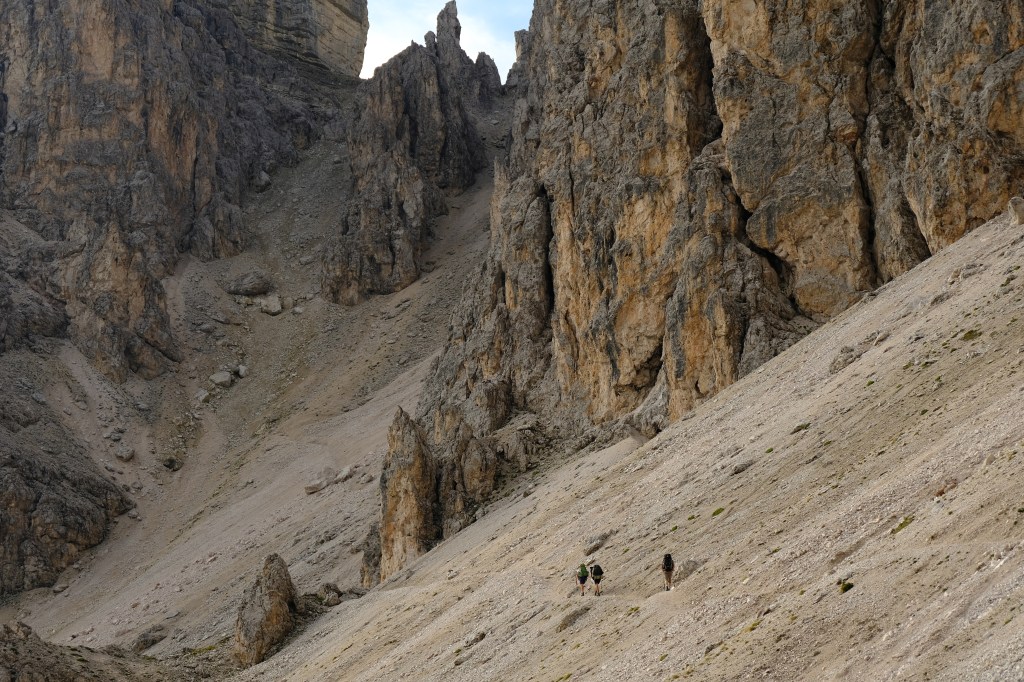
Photo credit: Sally Woodbridge
There is an optional diversion to the top of Piz Duleda at 2909m for panoramic views south across the Dolomites and north to the snowy spine of the Alps. On the final section, just after crossing a small stream on the high grassy plateau, you may hear the bird-like alarm whistles of marmots. Patience might reward you with glimpses of these brown furred, small dog-sized rodents basking in the sun or munching the meadow.
The Ladin language evolved from the Raetian language of the local Raeti tribes and the everyday Latin used by the Romans who occupied the area in 15 BC. Despite changes of rulers, a three language (Ladin, German and Italian) culture existed up until 1784. The annexation of the territory by Kaiser Joseph II of the Habsburgh Empire resulted in German becoming the official language. After the First World War the Dolomites were ceded to Italy and in 1923 the Fascist state designated Italian as the only official language. In 1948 South Tyrol Ladin was recognised as the third provincial language, and since 1989 the Autonomous Province of Bolzano – South Tyrol has recognised Ladin as an administrative language with equal status to German and Italian.
The day ends on a superb balcony path with views across the glacier hewn Vallunga / Langental to the bustling Puez Hütte / Rifugio Puez and a summer herd of friendly, leggy, slightly smelly Tyrolean Mountain sheep.
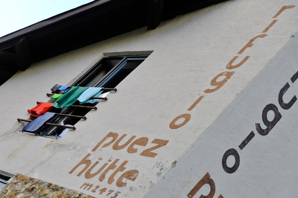
Photo credit: Sally Woodbridge
Walk directions
Day 1: Exit the funicular station and turn right on a broad track, Path 35. In 300m you will come to a small mountain Hut, Malga Cason on your right. In 100m turn left and follow a small path uphill to reach a junction with Path 31. Turn right along path 31 following the path as it loops round the upper edge of the plateau to a path junction at Forcella di Valluza / Flitzer Scharte / Locia da Piz. Keep straight ahead staying on the plateau and in 600m the path merges with the broad track of Path 35. Turn left and follow this track for nearly 3km to the pass Passo di Borgles / Brogles Sattel at 2119m. Keep straight ahead and descend to the Brogles Hütte / Rifugio Brogles.
Path 35 now becomes the Adolf Munkel Weg / Via delle Odle as it rises and falls following the tree line below the Odle / Geisler peaks. Follow this trail for 8km to a crossing track and bridge over a stream. Cross the stream and continue ahead on the track, still marked as Path 35. This track gradually ascends out of the tree line to reach the Malga Gampenalm on your left. Staying on the track, Path 35 continues ahead and ascends to the Schlüterhütte / Rifugio Genova.
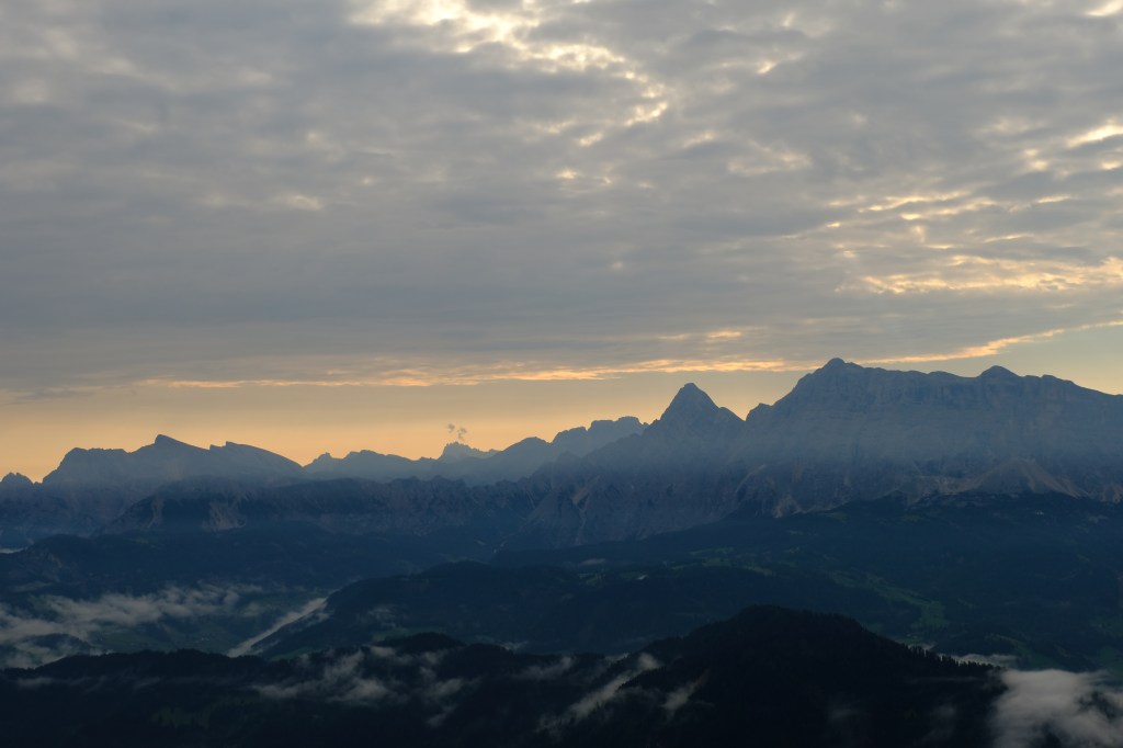
Photo credit: Sally Woodbridge
Day 2: From the Schlüterhütte / Rifugio Genova head south east on Path 3. After 300m turn right as Path 3 becomes the Alta Via 2 / Dolomiten Höhenweg. The path threads through a pass and bears right and down to the Baita Medalges / Medalges Alm. Keep above the hut and head up towards the pass, the Furcella de Furćia / Kreuzjoch, do not go through the pass. Keep ahead heading southwards on Path 3 as it hugs the western slopes of the valley for 3km, ignoring path 5a to the left and path 13 to the right. On reaching the narrow eroded pass Furcella dla Roa bear left staying close to the steep rock walls. In 500m you will see the route climb up through the cliff with metal cables bolted to the rock to aid progress.
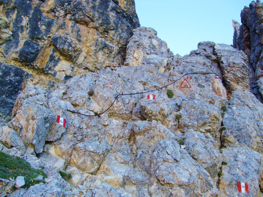
Photo credit: Sally Woodbridge
From the pass at the top you can continue to the hut or take the steep scree path to your left to ascend Piz Duleda (2909m). From here there are views of Pelmo, Civetta and the Marmolada in the Dolomites and the main alpine ridge to the north.
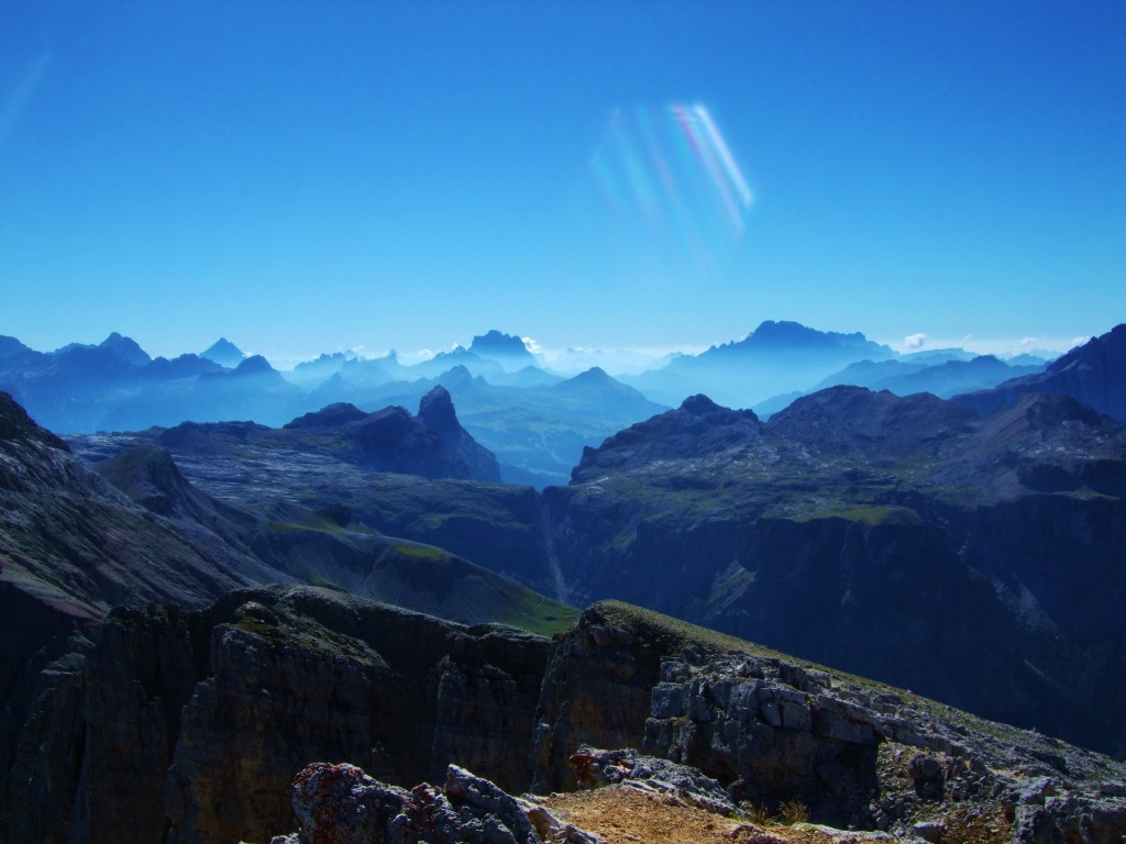
Photo credit: Sally Woodbridge
From the pass below Piz Duleda continue west on Path 3A and descend to a path junction on Munt de Puez. Turn left and continue descending gradually and cross a small stream. At the junction with Path 16 on your right keep heading south following the Alta Via 2 / Dolomiten Höhenweg. The Path then swings eastwards on a spectacular balcony path with views across the Vallunga / Langental before rounding a final rocky outcrop on your left to deliver you to the Puez Hütte / Rifugio Puez.
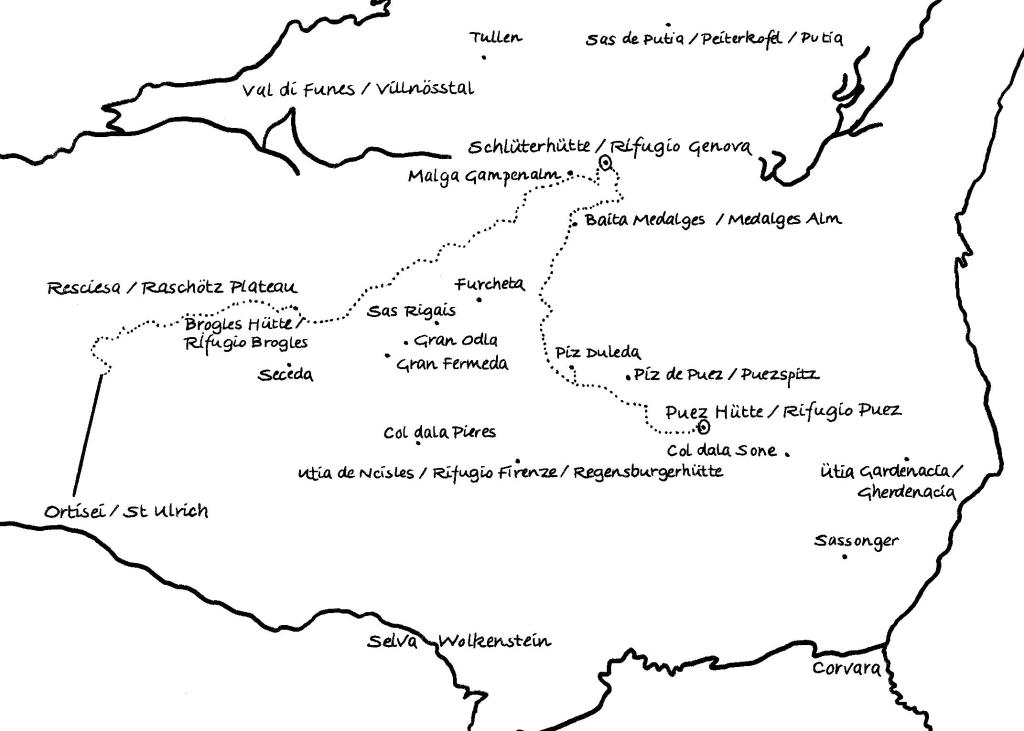
Map
Accommodation details
The Schlüterhütte / Rifugio Genova http://www.schlueterhuette.com/Schlueterhuette_en/Welcome.html
The Puez Hütte / Rifugio Puez http://www.rifugiopuez.it/en/
